ABOUT US
Surveys4architects.co.uk is an independent family run business, specialising in Land Surveys, Building Surveys & Utility Surveys based in Dorking, Surrey with easy access to London and the South East
From the start of your project to the very end, Surveys4architects.co.uk offer an extensive one stop range of services that covers every aspect of surveying, investigation and monitoring. In doing so we pass on a number of valuable advantages. We pride ourselves on high quality work with a meticulous attention to detail, at very competitive prices. Our experience allows us to complete project quickly and efficiently. We strive to stay ahead of the competition using the latest techniques and developing technologies.
This approach means that clients can rely on all areas being covered by a single, highly knowledgeable point of contact throughout the job.
For a free quote or consultation call on; 07876 773 711 or: 01 306 881 779
or email colin@Surveys4architects.co.uk.
WHY CHOOSE US?
Our surveys are conducted using the latest processing and AutoCAD software. The final drawings are presented in .DWG and .PDF format. Clients individual specifications and needs are always catered for.
LATEST TECHNOLOGY
Technology changes all the time so we keep up to date with the latest technology and invest in sophisticated surveying equipment. Combined with regular training, our experience and attention to detail, ensures that we maximise the advantages of having the best technology around – and our clients enjoy the cost savings and reap the benefits of increased productivity when time on site is restricted.
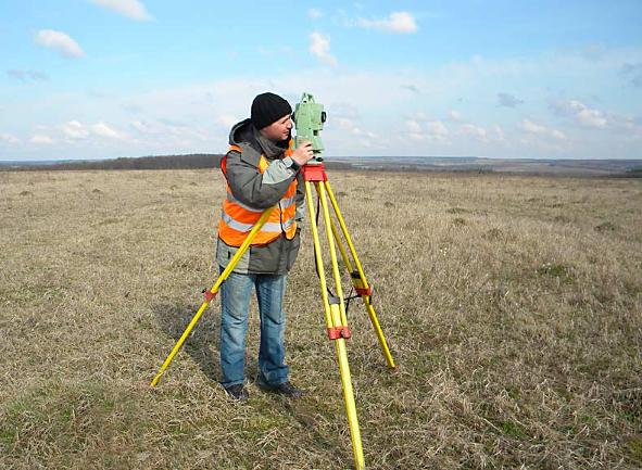
The latest reflectorless/robotic total stations are precision optical instruments which combine an electronic distance measuring device (EDM) with an electronic theodolite. They are able to measure distances and angles with extreme accuracy, as well as feature codes and point attributes. This information is then used to record survey points. The one man robotic feature on these machines means that only one person needs to visit the site to carry out the work.
Entire drawings can be directly uploaded on to our total stations for site visits meaning additions and adjustments can re made instantly on-site, so nothing gets missed or left out. Using this advanced technology, we can identify site features and levels, show the plan location and height of adjacent buildings and also overlooking windows. Data can be processed at any scale and contours produced at any interval.
- Topographical Surveys
- Land Mapping
- Site Sections
- 3D modelling
- Boundary Surveys
- Block Plans for Planning Permission
- Land Registry Compliant Drawings
- CAD Drafting
- GPS
- Observations Accurately Positioning Data to OS Network
- Measured Building Surveys
- Floor Plans
- Elevations
- Sections
- 3D Scanning
- Underground Services
For a free quote or consultation call on;
07876 773 711
or: 01 306 881 779
or email colin@Surveys4architects.co.uk.
Surveys4architects.co.uk... serving London and the South East